Freight App Sample

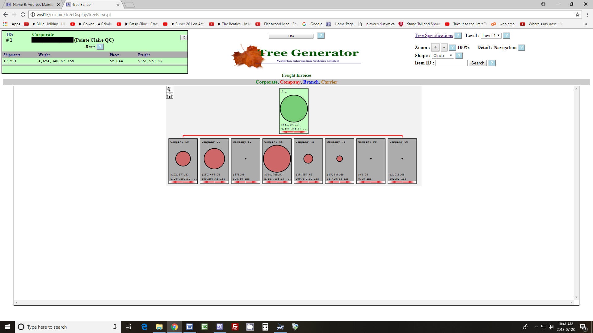
At level 1 the top object summarizes the corporate freight cost and weight for the specified period (in this case one month) and displays the directly subordinate corporate entities where the object images reveal the relative size in terms of freight cost. Company 75 is selected to display its detail.
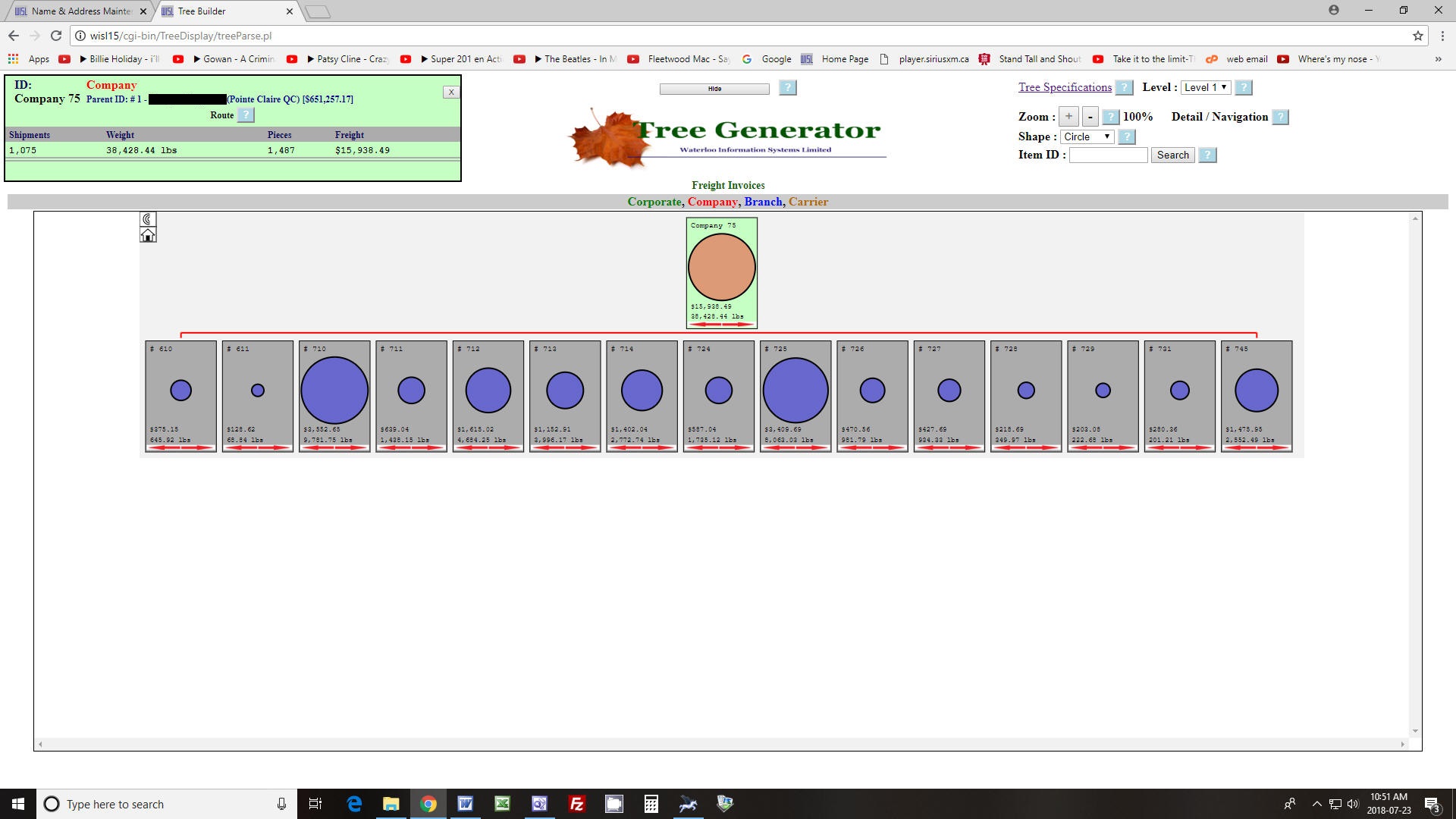
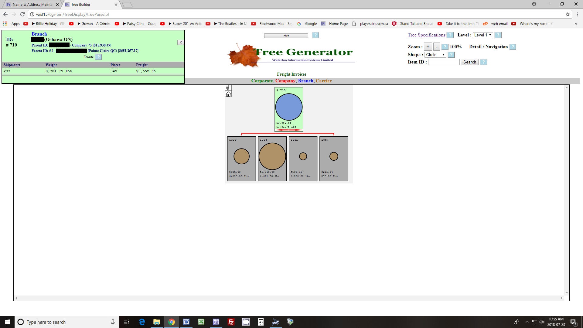
The branches of company 75 are displayed where the object images reveal relative size in terms of freight cost. Company 710 is selected to display carriers used.
Selecting a carrier displays detail of individual shipments.
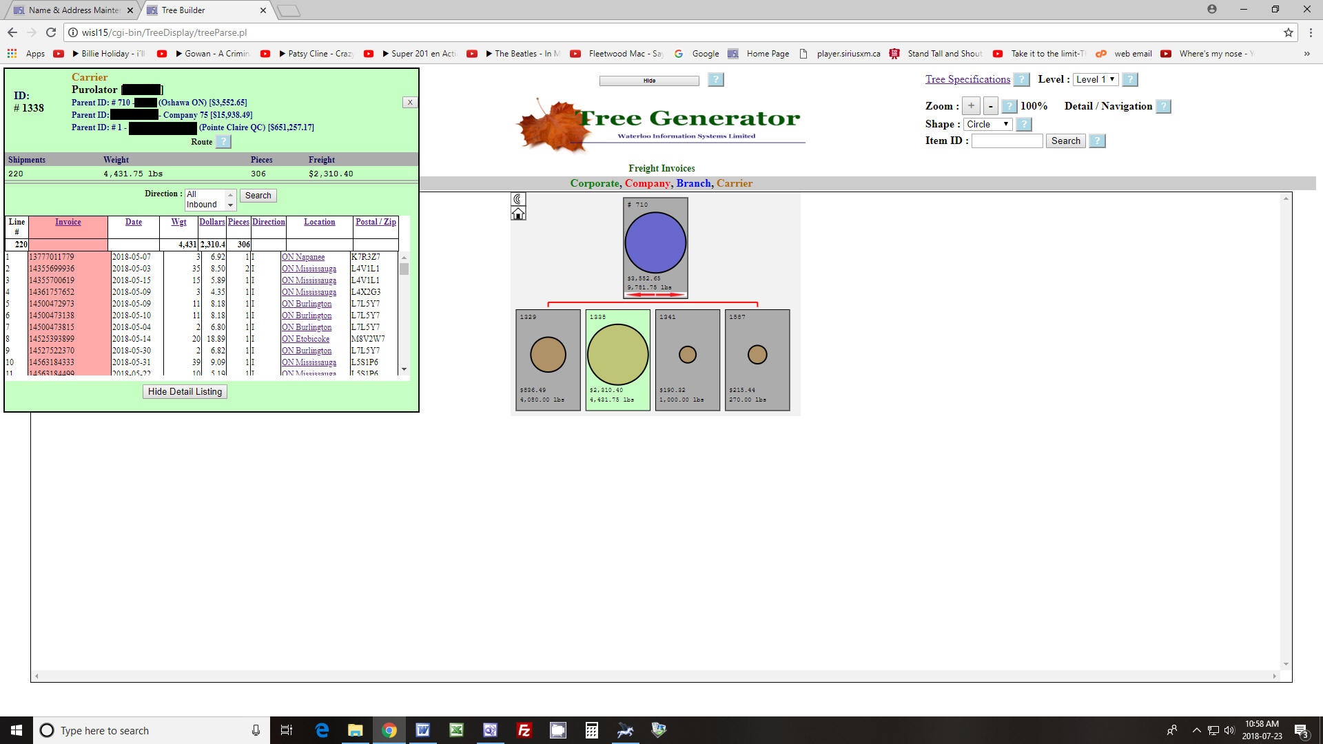
Selecting any heading of the detail list sorts the list by that column.
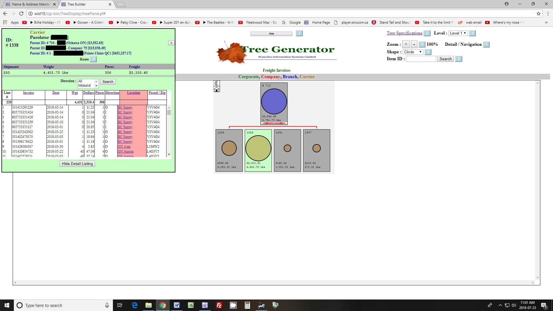
The Search provides for selection of any combination of shipment direction codes (in this case "O" for Outbound)
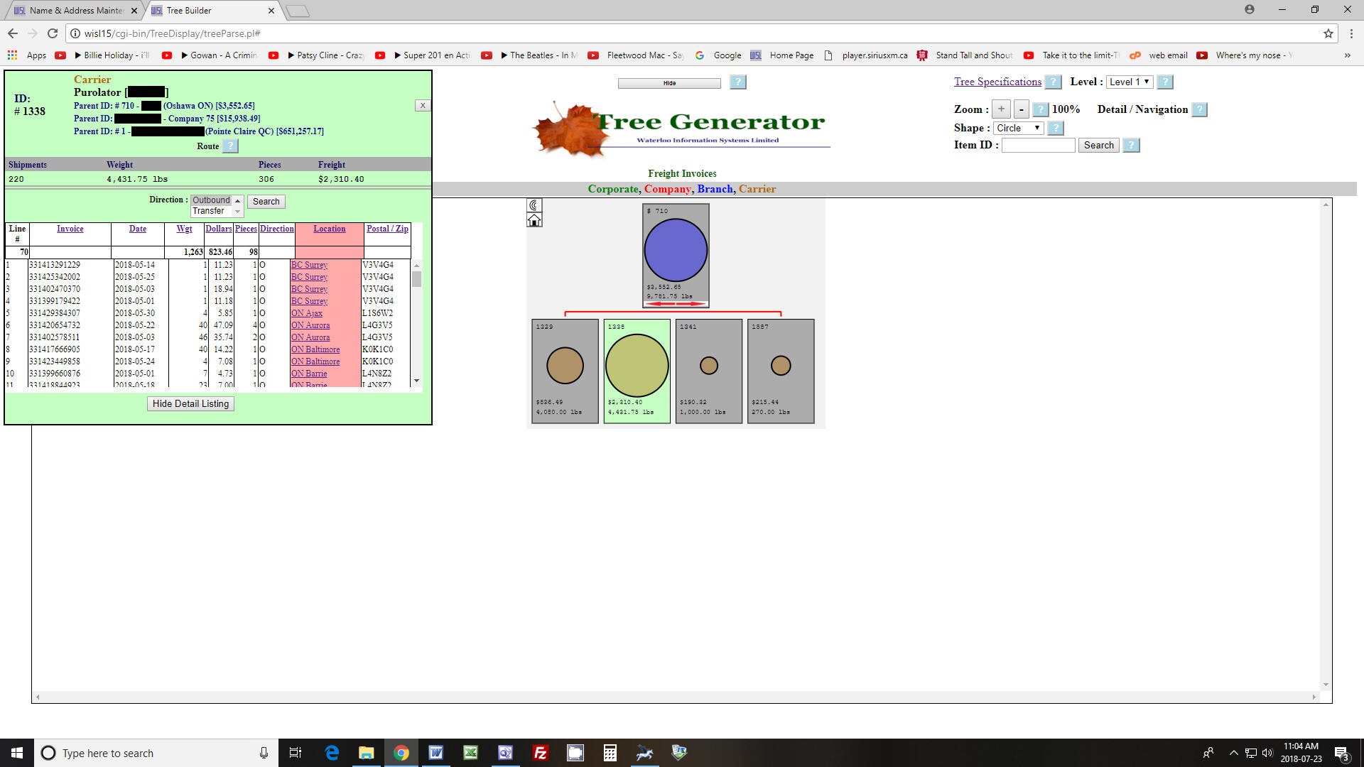
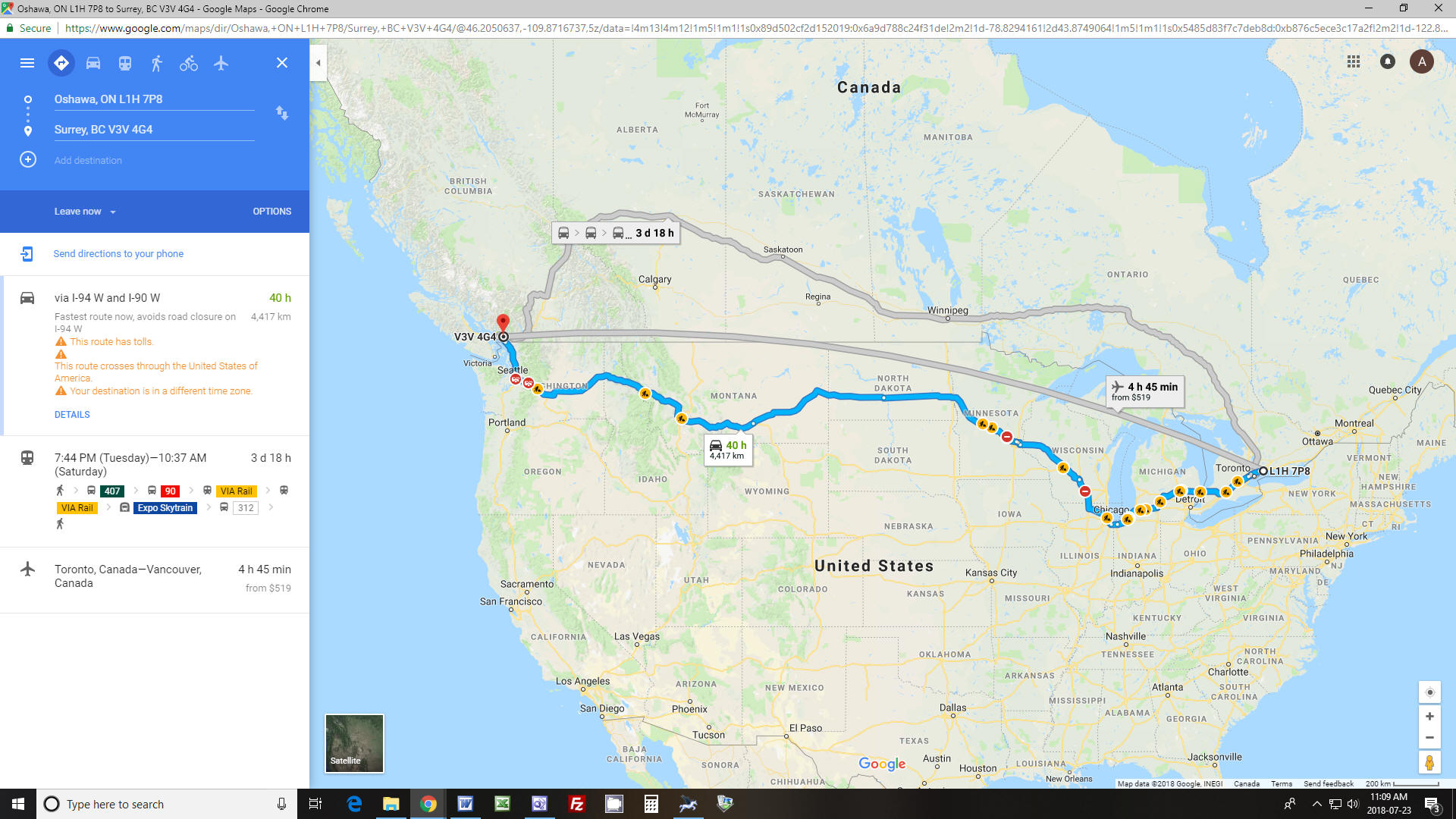
Now only outbound shipments are shown in the list with summaries above the columns adjusted accordingly. The app also provides for integration with Google Maps to provide the route of the shipment by selecting the "Location" attribute of the desired shipment:
 All
All
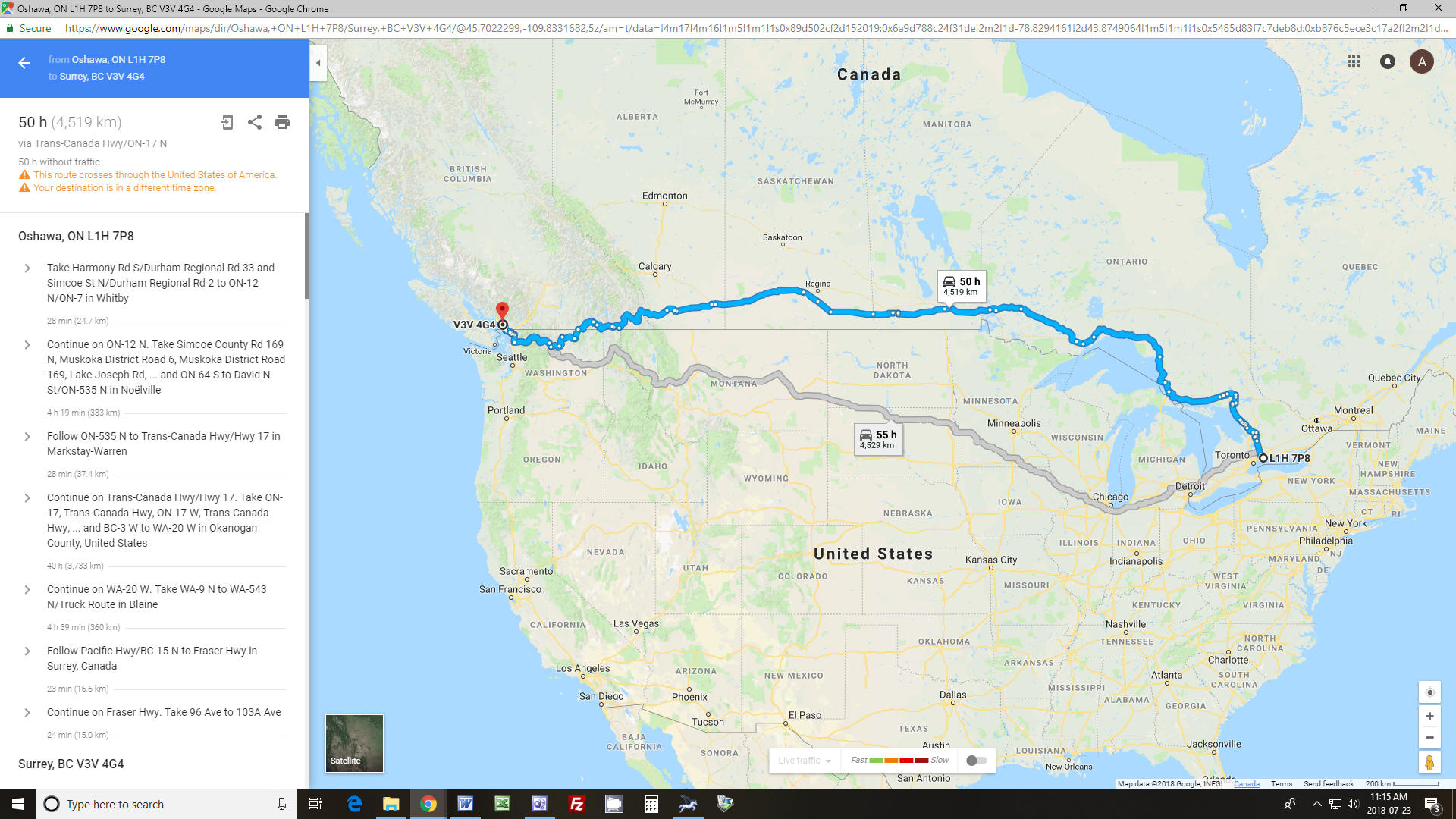
All of the features of Google Maps are available, for example by adjusting options the shipment may be routed only through Canada:
By selecting "X" in the top right corner you are returned to Tree Generator:
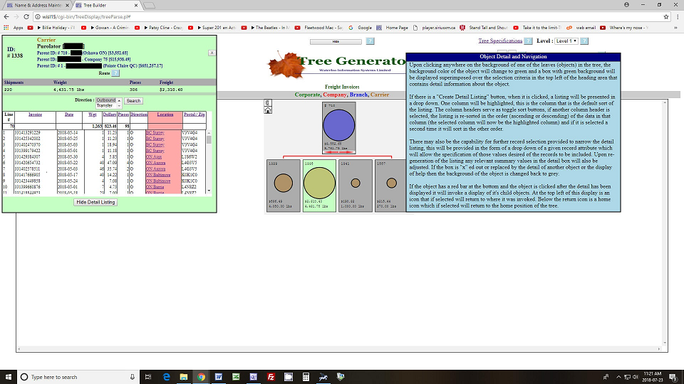
By doing mouse over any of the "?" icons beside the labels on the display, help text is displayed explaining that feature, in this case for Object Detail/Navigation.